GPS Mapping
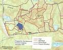 Global positioning system (GPS) is a relatively new technology that has enhanced the abilities of land use managers. We can utilize this technology to provide more accurate mapping and that leads to more accurate volume and value estimates. GPS mapping can help make accurate acreage estimates for reforestation efforts, which in turn saves the landowner money.